↓
 

Dallas Land Surveying

Local Land Surveyors in Dallas, TX

  • Home
  • Services in Texas
  • ALTA Survey
  • Boundary Surveying
  • Construction Survey
  • Drone LiDAR Mapping
  • Elevation Certificate
  • Land Surveying
  • Topographic Survey
  • Blog
  • Contact Us
Home 1 2 3 … 8 9 >>

Post navigation

← Older posts

Welcome to Dallas Land Surveying

Dallas Land Surveying Posted on December 18, 2018 by DallasLSMay 20, 2019

This site is intended to provide you with information on Land Surveying in the Dallas, TX and Dallas County and surrounding areas of Texas. If you’re looking for a Dallas Land Surveyor, you’ve come to the right place. If you’d rather talk to someone about your land surveying needs, please call our local number at (214) 396-0266 today. For more information, please continue to read.

land surveyingLand Surveyors are professionals who make precise measurements to determine the size and boundaries of a piece of real estate.  While this is a simplistic definition, boundary surveying is one of the most common types of surveying related to home and land owners. If you fall into the following categories, please click on the appropriate link for more information on that subject:

Dallas Land Surveying services:

    1. I need to know where my property corners or property lines are. (Boundary Survey)
    2. I have a loan closing or re-finance coming up on my home in a subdivision. (Lot Survey)
    3. I need a map of my property with contour lines to show elevation differences for my architect or engineer. (Topo Survey)
    4. I’ve just been told I’m in a flood zone or I’ve been told I need an elevation certificate in order to obtain flood insurance or prove I don’t need it. (Flood Survey)
    5. I’m purchasing a lot/house in a recorded subdivision. (Lot Survey – See Boundary Survey if you’re not in a subdivision.)
    6. I’m purchasing a larger tract of land, acreage, that hasn’t been subdivided in the past. (Boundary Survey)

Contact Dallas Land Surveying services TODAY at (214) 396-0266.

Posted in boundary surveying, elevation certificate, land surveying, land surveyor | Tagged boundary survey, Dallas Land Surveying, land surveyor, land surveyor dallas tx

ALTA Survey Due Diligence for Urban Property Deals

Dallas Land Surveying Posted on July 9, 2026 by DallasLSJuly 3, 2026
Aerial view of an urban property area showing why parcel access and site limits need careful review before a deal

Buying commercial property in a crowded city means dealing with facts that are easy to miss and costly to get wrong. An ALTA survey brings those facts into focus during due diligence. It does this before a buyer signs and the money changes hands. The survey maps boundaries, improvements, access and title-related conditions. It works best on sites that sit close together, where a few feet can decide a deal. In a tight market, that clarity protects a buyer from surprises that surface only after closing. The survey answers questions a purchase agreement assumes but never checks.

Reviewing Property Conditions in Tight Urban Settings

Urban parcels rarely stand alone. Buildings press up against property lines. Alleys thread between structures. One owner’s improvement can spill onto another’s land. An ALTA survey sorts through that tangle. It shows a buyer exactly what a commercial or mixed-use property includes and where its limits fall.

That clarity carries real weight when sites sit inches apart. A wall that leans a foot over a line can spark a dispute. So can a canopy that crosses into a neighbor’s air space. Reviewing these conditions during due diligence lets a buyer see the property’s true footprint. They no longer have to trust a rough description.

Checking Access and Shared Use Areas Before Closing

Access can make or break an urban property. A survey review pins down the driveways, alleys, shared parking and access lanes a site depends on. In dense areas, those features often cross several parcels. That makes confirming them before closing especially important.

Shared use raises questions a buyer needs answered up front. Who has the right to use a common alley? Does the property’s parking actually sit on its own land? An ALTA survey lays out these arrangements clearly. A buyer then understands the access they are paying for, instead of discovering gaps after the deal closes.

Delivery access deserves the same attention in a commercial deal. A tenant might need room for trucks to reach a loading area. A survey shows whether the site can handle that traffic. It also shows whether the route depends on a neighbor’s cooperation.

Comparing Visible Improvements With Title Information

A title document describes a property in words. An ALTA survey checks those words against what stands on the ground. The surveyor compares buildings, walls, signs, parking and other improvements with the records tied to the title. Gaps between the two often point to problems worth solving before a purchase.

These comparisons catch issues that paperwork alone hides. A fence might sit off the recorded line. A shed might cross an easement. A sign might land on a neighbor’s parcel. All of it shows up when survey and title meet. Spotting those mismatches during due diligence gives a buyer room to negotiate or walk away with clear eyes.

Some mismatches take real time to clear. A title fix or a boundary agreement can stretch for weeks. Finding the issue early gives everyone time to sort it out before closing day.

Helping Buyers Understand Use Limitations Early

Not every urban property can be used the way a buyer imagines. An ALTA review can flag conditions that limit financing, redevelopment, occupancy or future use. It flags them while a buyer still has choices. Learning about a restrictive easement early beats learning about it after the keys change hands.

Those early flags lead to smarter decisions. A lender may hesitate over a property with unresolved access issues. A redevelopment plan may stall if an easement blocks the best building spot. When a buyer sees these limits during due diligence, they can price the risk, ask for fixes or move on. Every one of those options beats a nasty surprise later.

Timing gives these flags their real value. A buyer who learns about a limit during the review period still holds real bargaining power. The same news after closing leaves them stuck with the problem. An ALTA survey puts the facts on the table while the deal can still bend.

Creating a Stronger Record for Commercial Ownership

An ALTA survey keeps working long after a deal closes. The document becomes part of the owner’s permanent record. It supports future refinancing, resale and planning. A commercial owner who holds an accurate survey can answer questions about the property for years without starting over.

That lasting value shows up at the next transaction. When an owner refinances or sells, the other side often wants the same detailed picture. The original survey provides it. Holding a strong survey record makes those later steps smoother and gives an owner a firmer grip on the asset.

Frequently Asked Questions

Why are ALTA surveys useful for urban property deals?

They help a buyer review boundaries, improvements, access and title-related conditions before closing. That matters most on tight urban sites where parcels sit close together.

Can an ALTA survey show shared access areas?

Yes. It maps alleys, driveways, parking areas and other access features. A buyer then sees which routes serve the property and who else may share them.

Who reviews ALTA survey findings during a deal?

Buyers, attorneys, lenders, brokers, surveyors and title companies all study the findings as part of due diligence. Each one looks for different things, which is why a single survey serves the whole group.

Does ALTA survey review help after closing?

Yes. It builds a property record that supports future financing, resale and redevelopment well beyond the original deal.

Posted in ALTA Survey | Tagged alta survey

Construction Survey Layout for Compact Housing Builds

Dallas Land Surveying Posted on July 8, 2026 by DallasLSJuly 3, 2026
Construction team reviewing plans inside a compact housing build before layout and finishing work continue

Small lots punish mistakes. When a home has to fit onto a narrow parcel with almost no wiggle room, construction survey layout keeps the build in the right place. Crews rely on those field marks to set a house, an addition or a housing unit exactly where the plan calls for it. On a compact site, a foundation set even a little off can crowd a property line or block a driveway. Fixing that later costs far more than getting it right the first time. Accurate layout turns a tight lot into a buildable one.

Setting Accurate Layout Marks on Small Lots

A surveyor takes the dimensions from a plan and stakes them onto the actual ground. Those stakes and marks show crews where corners, walls and edges belong. The guesswork drops away. On a small lot, that precision decides whether a house even fits within the allowed space.

Compact sites leave almost no margin for drift. A foundation that creeps a foot the wrong way can eat into a setback. It can also push against a neighbor’s line. Once concrete cures, moving it is rarely an option. Careful layout marks hold the build inside its boundaries from the very first day of work. That head start sets the tone for the entire job.

Protecting Required Space Around the Build Area

Every housing lot carries required open space around the structure. Crews have to respect it. Layout staking shows exactly where construction should stop. Work then stays inside the buildable area and out of the tight margins around it. That boundary keeps a project in step with local rules.

On a crowded parcel, those margins can shrink to just a few feet. Staking gives crews a clear line they can see and trust. Materials, foundations and equipment stay out of space that has to remain clear. Marking that line early spares a builder from tearing out work that strayed too far.

Inspectors check those margins too. A structure that crowds a setback can fail a review and stall the job. Clear stakes give a crew a simple way to stay compliant. They build to the mark and pass the check without a fight.

Coordinating Foundations With Driveways and Utilities

A house never stands alone. Its foundation has to line up with the driveway, the water and sewer lines and the other improvements that make the property work. Layout marks tie the building footprint to those elements. Everything then fits together once the ground opens up.

That coordination heads off clashes underground and at the surface. A foundation set without regard to the utility route can block a service line. A house placed too far one way can leave no room for a proper driveway. Field marks that account for all of these pieces keep the build and its connections working as one plan.

Grade matters here as much as position. A driveway that meets the garage at the wrong height creates a bump or a dip. A layout that carries elevation, not just location, keeps those surfaces flowing together. The finished site works the way the plan drew it.

Reducing Rework on Fast Urban Housing Sites

Urban housing crews often move fast, and speed magnifies the cost of any error. Construction survey layout guards against expensive mistakes. It gives crews reliable marks to build against from the start. When the layout is right, the work moves quickly without drifting off target.

Rework on a compact site hits hard. Ripping out a misplaced footing wastes days. Shifting a wall burns through the budget a tight project cannot spare. Solid layout keeps crews building forward. They stop circling back to fix work that never sat where it should have.

Speed and accuracy usually pull against each other, but good layout lets a crew have both. The marks are already correct, so nobody has to slow down to double-check the plan. The pace stays high and the work stays clean.

Helping Builders Keep Plans Practical in the Field

A set of plans means little until someone turns it into points on the dirt. Field layout does exactly that. It converts plan dimensions into physical marks a builder can follow step by step. That translation bridges the gap between a drawing and a real structure.

Builders lean on those marks to keep the work honest. Instead of scaling measurements off a sheet and hoping, they build straight to stakes that already carry the correct dimensions. On a compact housing site, that reliable link between plan and ground keeps the whole project moving in the right direction.

The marks give a builder confidence to move fast. They can trust the layout and focus on the work itself. On a tight lot, that trust keeps a crowded schedule on track.

Frequently Asked Questions

Why is construction layout important for compact housing?

Small sites leave little room for error, so accurate field marks keep crews building in the planned location. That precision protects setbacks, boundaries and the fit of the whole structure.

Can survey layout help with driveways and utilities?

Yes. Layout marks tie the building placement to access routes and service lines. Foundations, driveways and utilities then line up as one plan.

When should compact housing layout be completed?

Finish it before excavation, foundation work, utility installation or any major site improvements begin, so every step starts from correct marks.

Who uses construction survey layout marks?

Builders, excavation crews, concrete crews, utility teams and site contractors all work from the same layout on a housing build. One shared set of marks keeps every trade aligned.

Posted in construction | Tagged construction survey

Why an ALTA Survey Is Becoming Essential Near Expanding Commercial Corridors

Dallas Land Surveying Posted on July 1, 2026 by DallasLSJune 24, 2026
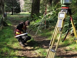
Development professionals reviewing site plans near expanding commercial corridors during an ALTA survey planning process.

When business areas grow and change, properties around them face new rules and new ways of working together. An ALTA survey goes far beyond marking simple lines on a map. It gives a full, clear picture of how a site sits within a shifting landscape. This kind of detailed record helps owners keep up with changes, protect their investment, and plan ahead as nearby activity increases.

Commercial Corridor Growth Is Creating New Property Relationship Challenges

As retail centers, warehouses, and mixed-use buildings spread outward, the way properties connect to one another also shifts. Areas that used to be quiet or separated now share roads, parking flow, and access points. More traffic and heavier use mean that what happens on one lot directly affects what happens next door.

These changes bring up questions about how everyone will move through the area and how spaces will work together. Without clear information, owners may face confusion over shared routes or new limits on how they can use their own land. An ALTA survey lays out all these connections in one document. It shows how sites relate to each other and helps avoid conflicts before they start.

ALTA Survey Data Helps Track Physical Changes Around Established Properties

Roads get widened, new utility lines get laid, and old lots get turned into larger projects. These changes do not just happen on the construction site. They can alter drainage patterns, change sightlines, or even shift how people reach a property. Over time, small adjustments add up and create a very different setting from what existed years ago.

An ALTA survey captures the exact layout of a site at a specific point in time. It records building positions, driveway locations, and the distance to nearby roads or structures. Having this fixed record makes it easy to compare current conditions with future changes. Owners can see clearly how upgrades around them may impact their own operations or plans.

Redevelopment Activity Is Increasing the Need for Existing Conditions Documentation

Many older commercial sites are being updated or repurposed to fit new market needs. Before any design or construction begins, everyone involved needs to know exactly what is already there. Outdated records or rough sketches often leave out details that matter most.

Lenders, investors, and planners all want proof that the site matches what is described. An ALTA survey provides this proof. It notes every visible feature from building walls and paved areas to sidewalks and light poles. This level of detail reduces guesswork and sets a solid starting point for any renovation or new build. It also shows where there is room to grow and where existing structures or improvements will stay.

ALTA Survey Reviews Support Coordination Between Adjacent Commercial Projects

When two or more developments happen close together, they cannot be planned in isolation. Driveways must line up properly, service lanes must stay clear, and drainage paths must work for everyone involved. If each team uses different measurements or maps, mistakes can happen quickly.

An ALTA survey creates a shared set of facts. All parties work from the same accurate data, so they can align access routes and site improvements without confusion. This shared view makes it easier to coordinate schedules and design choices. It helps projects fit together smoothly and reduces the risk of delays or disputes during and after construction.

Property Visibility and Frontage Considerations Are Receiving Greater Attention

For commercial properties, how the site looks and connects to the main road plays a big role in its value. Lots with wide frontage or good visibility from busy streets often attract more customers and hold their worth better. Even small changes in setbacks or access points can change how well a property functions.

An ALTA survey measures and records these key features. It shows the exact length of road frontage, the angle of driveways, and the distance between buildings and public roads. It also notes any physical features that may block views or limit access. This information helps owners understand their best selling points and how to make the most of them as the area continues to grow.

Frequently Asked Questions

How can an ALTA survey help when nearby commercial development is occurring?

An ALTA survey provides detailed documentation of site conditions that may be affected by surrounding growth and infrastructure changes. It gives owners a clear reference point to understand how new projects or road work may impact their own property.

Is an ALTA survey useful for properties that are not being sold?

Yes. Property owners often use ALTA survey information to evaluate future improvements, redevelopment opportunities, and changing site conditions. It acts as a reliable record that supports planning and decision-making long after the report is complete.

What site features are commonly documented in an ALTA survey?

An ALTA survey may identify buildings, parking areas, access points, visible improvements, utility features, and other important property characteristics. It captures all details that affect how the land is used or valued.

Why do lenders often request an ALTA survey for commercial properties?

Lenders use ALTA survey information to better understand site conditions that could affect the property’s value or future use. It reduces uncertainty and helps them make sound decisions about financing.

Can an ALTA survey support commercial property redevelopment projects?

Yes. Accurate site documentation can help project teams evaluate existing conditions before planning renovations, expansions, or redevelopment activities. It highlights what is already in place and guides designs that fit the site properly.

Posted in ALTA Survey | Tagged alta survey

Post navigation

← Older posts
Get Quote Button
© Copyright Boxer Survey USA
Dallas Land Surveying

Dallas, Texas
Phone: (214) 396-0266

Web Development and SEO by:
AuburnBusiness.com, LLC


Privacy Policy | Terms of Use

The owner of this website, Boxer Survey USA, provides coordination of professional land surveying and engineering services in all 50 states. The professional surveying and engineering services provided to you will be conducted by fully licensed professionals in your state.

↑