
↓
 

Dallas Land Surveying

Local Land Surveyors in Dallas, TX

  • Home
  • Services in Texas
  • ALTA Survey
  • Boundary Surveying
  • Construction Survey
  • Drone LiDAR Mapping
  • Elevation Certificate
  • Land Surveying
  • Topographic Survey
  • Blog
  • Contact Us
Home - Page 2 << 1 2 3 4 … 8 9 >>

Post navigation

← Older posts
Newer posts →

ALTA Survey Reviews Are Expanding Beyond Property Boundaries

Dallas Land Surveying Posted on June 29, 2026 by DallasLSJune 25, 2026
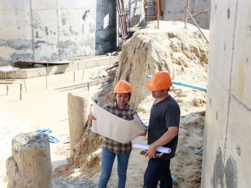
Survey and construction professionals reviewing commercial site plans during an ALTA survey and pre-development assessment.

When people hear the term ALTA survey, they usually think it only marks property lines. That idea is no longer true. Today, an ALTA survey looks at much more than where one lot ends and another begins. It covers every detail that affects how a property can be used, accessed, and developed. This wider view helps owners, buyers, and planners make smarter choices with full confidence in what they own.

ALTA Survey Research Is Increasing Around Recorded Access Rights

Access is one of the most important parts of any property. A lot can have plenty of space, but it holds little value if there is no legal way to reach it. ALTA surveys now spend more time reviewing all agreements related to entry and exit. They look at shared driveways, private roads, and any written rights that let people pass through certain areas.

These details make a real difference. A property might look easy to reach on a map, but actual access can depend on rules set years ago. When those rules are clearly recorded, everyone knows what is allowed. This clarity keeps future plans on track and avoids problems when it comes time to refinance, sell, or build.

Utility Infrastructure Is Becoming a Larger Part of ALTA Survey Analysis

Underground and above-ground utilities shape almost every part of commercial land use. Power lines, water pipes, gas lines, and communication cables run across many properties, often without being visible from the surface. ALTA surveys now map these features with great care. They also note any official rights that allow utility companies to use or maintain these lines.

Knowing where these systems sit helps avoid costly mistakes later. Construction crews cannot dig or build in areas reserved for utilities. This information also shows what parts of the land are free to use and what areas must stay clear. Key details captured in this part of the review include:

  • Exact location of pipes, cables, and power lines
  • Width and length of each service corridor
  • Rules that limit building or digging nearby
  • Any obligations to keep access open for repairs

With this information, owners can plan improvements without interfering with critical services.

ALTA Survey Reviews Now Support Long-Term Site Planning Decisions

Many property owners buy land with plans to grow over time. They may want to add more buildings, expand parking areas, or change how the space is laid out. ALTA survey data gives them a clear picture of what is possible long before any work begins.

The survey shows the true shape of the land, the position of existing structures, and all legal limits that apply. Teams can test different layout ideas and see which ones fit within the rules. They can also identify areas that offer the most room for change and areas that will stay fixed. This approach makes planning faster and more accurate. It helps owners set realistic goals and avoid plans that will not work once construction starts.

Encumbrance Verification Has Become More Detailed During Property Reviews

An encumbrance is any condition or agreement that affects how land can be used. These can include leases, licenses, and rights granted to others. In the past, surveys often only noted the existence of these items. Now, they describe each one in full detail.

This deeper look reveals exactly what rights others have and what responsibilities the owner must follow. For example, a lease might limit how a certain building can be changed. A right of way might prevent fencing across a specific path. When these conditions are fully understood, they no longer come as surprises. They become part of the full picture used to decide how to manage or improve the property.

ALTA Survey Findings Are Being Used Across Multiple Professional Disciplines

The information from an ALTA survey is useful to more people than just surveyors and owners. Lawyers use it to review contracts and confirm legal rights. Engineers rely on it to design safe and stable improvements. Architects use the measurements to create layouts that fit the land properly.

Lenders and planners also depend on these reports. They need clear facts to approve loans, issue permits, and make sure projects follow local rules. Because the survey follows a standard format, every professional reads the same set of facts. This shared source of information reduces confusion and helps all teams work toward the same goals.

Frequently Asked Questions

What information beyond property boundaries can an ALTA survey identify?

An ALTA survey can document easements, access rights, utility corridors, encroachments, and other recorded conditions that may affect a property.

Why are utility easements important during an ALTA survey review?

Utility easements can limit where future structures, parking areas, or site improvements may be placed on a property. They also set rules for maintaining safe access to service lines.

Can an ALTA survey assist with future property development planning?

Yes. ALTA survey information can help identify physical and legal constraints that may influence future site improvements or expansion projects. It gives a clear starting point for any design work.

Who commonly uses ALTA survey data besides property owners?

Attorneys, lenders, engineers, architects, developers, and title professionals often rely on ALTA survey findings during property evaluations. Each group uses the data to support their own work.

How do recorded encumbrances affect commercial property decisions?

Encumbrances may create restrictions or obligations that influence financing, development plans, property operations, or future transactions. Understanding them early helps owners make choices that fit the true status of the land.

Posted in ALTA Survey | Tagged alta survey

How a Construction Surveyor Helps Dallas Builders Coordinate Multi-Phase Commercial Developments

Dallas Land Surveying Posted on June 26, 2026 by DallasLSJune 21, 2026
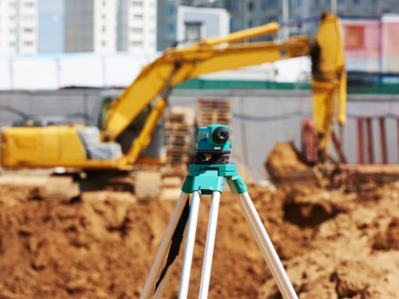
Construction survey equipment set up on a commercial job site to support layout and coordination during phased development.

Big commercial projects in Dallas don’t get built all at once. A shopping center opens its first stores. The rest of the land waits empty. An office park starts one building while another is still just a drawing. This takes time. But it creates a real problem. How do you make sure buildings and roads built years apart still line up correctly? A construction surveyor is the answer. They make sure every phase connects to the one before it, even if years pass between them.

Starting Right with Phase One

The first phase sets everything else up. Roads. Utility lines. Where buildings go. Where parking areas sit. Every choice in phase one affects what comes later. Surveyors place permanent markers during phase one. These same markers are used for every future phase. Whether the project takes two years or five years, these original markers guide the new construction teams. That’s how roads from different phases meet at the right height. That’s how buildings end up in the right spots. Without this, small mistakes add up. One contractor builds a road at the wrong height. Another contractor builds parking where measurements were off by a couple feet. On one building, that’s not a big deal. On a huge project over many years, these mistakes become expensive to fix.

Keeping Pipes and Roads in the Right Places

Big commercial sites share pipes, drains, and roads. The drainage system built in phase one must handle the whole site. Pipes get put in years before some buildings are even built. Main roads are made to handle traffic from areas that don’t exist yet.

Surveyors check that all the utility lines are exactly where the plans say they should be. Before the next phase starts, they verify that roads will connect smoothly at the borders. They make sure the drainage slopes are correct. Sometimes what’s on paper doesn’t match what’s actually on the ground after several years.

Working with Multiple Construction Teams

One company rarely builds an entire multi-phase project. Different teams build different phases. Sometimes they work at the same time on opposite sides. Sometimes years pass between one team’s work and the next team’s start.

These teams don’t share notes with each other. Each one works from their own plans. The surveyor is the only person who stays the same throughout the whole project. They use the same markers. They use the same measuring system. Every new team that arrives works from the same original setup. This keeps the project from falling apart where two phases meet. Without it, both teams can do good work but still not connect properly at the boundary.

This happens with pipes that need to connect between different sections, parking lots that must flow smoothly across where phases meet, buildings next to each other that need to line up, and ground surfaces where one team’s finished work becomes the next team’s starting point.

When Plans Need to Change

Plans change on long projects. A shopping center loses a major store. An office building needs to be taller. An apartment section gets added to areas planned for offices.

This is normal. The hard part is making new plans work with what’s already built. Old survey records show exactly where roads, pipes, and buildings actually sit. Designers need this real information before they change anything. Without it, they’re just guessing. Guesses cause problems when crews show up and find out what’s really there. Changing a plan on paper takes a few hours. Making it work with what’s built requires real measurements.

Records That Stay Useful

A project that takes five years creates lots of survey paperwork. Height records. Pipe locations. Measurements of everything. Most of it gets filed away when the project ends.

But people need it later. A property manager needs to know the parking lot heights before fixing it. A bank needs to know where underground pipes are before lending money. A developer needs to know where pipes run before adding a new building. Survey records answer these questions. No searching through old emails. No calling contractors from years ago. The information is there and correct.

Frequently Asked Questions

What does a construction surveyor do on a multi-phase project?

They provide measurements and reference points that keep different phases connected and organized throughout the whole project.

Why are multi-phase projects different from single buildings?

Multi-phase projects take longer to build, so surveyors must keep everything connected over many years.

Can different contractors work on different phases?

Yes. Surveyors keep the same reference points for all contractors, so everything stays aligned.

Do surveyors help when plans change?

Yes. They provide the real field measurements that let designers change plans without creating problems.

Why keep survey records after building is done? T

hese records help with future repairs, additions, and financing. Banks and property managers use them.

What types of projects use multi-phase construction?

Office parks, shopping centers, apartment complexes, and industrial parks often use phased construction.

Posted in land surveyor | Tagged land survey

Why Dallas Homeowners Order a House Survey Before Adding a Pool, Guest House, or Detached Garage

Dallas Land Surveying Posted on June 24, 2026 by DallasLSJune 25, 2026
Land surveyor measuring a residential lot before adding a pool, guest house, or detached garage to the property.

The idea usually starts simple. A pool for the summers. Maybe a guest house down the line. A detached garage eventually. But somewhere between the idea and the permit application, Dallas homeowners run into a question they didn’t expect: does everything actually fit? A house survey answers that before the design process starts, and it saves a lot of headaches that tend to show up later when people skip it.

Choosing the Best Location for New Structures Without Limiting Future Options

Most homeowners think about where a pool or garage fits right now. That’s the wrong timeframe to be thinking about. A pool that gets placed in the best spot for today’s family might sit exactly where a guest house would go in five years. A detached garage built along one side of the lot might block the only reasonable route for a future driveway extension. These conflicts aren’t obvious when you’re standing in the backyard imagining how things could look. They become obvious on a survey map where everything is drawn to scale and the remaining space is measured rather than estimated.

A house survey gives homeowners a real picture of what’s available and what each choice costs in terms of future flexibility. Some placements that feel natural turn out to close off options that the homeowner cared about more than they realized. Catching that before construction begins costs nothing compared to catching it after concrete gets poured.

Understanding How Existing Improvements Influence Available Yard Space

A typical Dallas backyard has more stuff in it than people tend to account for. Fences, patios, AC units, gas meters, irrigation controllers, storage sheds, utility easements running across the corner. Each of these things takes up space or creates a zone where new structures can’t go.

When homeowners start mentally planning a pool or a guest house, they usually picture the open grass area and assume that’s what they’re working with. The actual buildable area is smaller. Sometimes significantly smaller.

Accurate measurements make the difference between a plan that works and one that gets redesigned twice at the architect’s hourly rate. A survey shows the dimensions of what’s already there, how the existing features relate to each other and how much room is genuinely available for something new. That information changes the conversation with a contractor from “here’s roughly what we want” to “here’s exactly what we’re working with.”

Why House Surveys Help Contractors Work From Accurate Measurements

Contractors, pool builders and architects all make better decisions when they start from reliable site information. That sounds obvious, but a surprising number of home improvement projects begin with someone pacing off distances or pulling measurements from an old listing sheet that may not reflect current conditions.

A detached garage that gets designed based on estimated dimensions might not clear the setback requirement when the permit gets reviewed. A pool layout drawn up without accurate measurements might need to shift after the designer visits the site and realizes the space works differently than the drawings suggested. These adjustments cost time and money, and most of them are avoidable.

When a homeowner shows up to a first meeting with survey documents in hand, the project moves differently. Questions that would have taken a site visit to answer get resolved in the office. The design process starts from a foundation of real numbers instead of reasonable guesses.

A few things survey documents help contractors confirm early in the process:

  • Exact setback distances from property lines to proposed structure locations
  • How existing hardscape and utility features affect available placement options
  • Whether the lot has enough room for the project as originally conceived

Creating Clear Property Records That Support Future Sales and Refinancing

A pool, guest house or detached garage changes a property. It adds square footage, changes the lot coverage and affects how a future buyer or appraiser evaluates the home. Having clear documentation of what was built, where it sits on the lot and how it relates to the property boundary is genuinely useful later.

Lenders sometimes ask questions during refinancing about improvements made after the original purchase. Buyers ask questions during due diligence about structures on the lot. Title companies occasionally want documentation when a property with significant improvements changes hands.

A homeowner who has survey records covering the property before and after major improvements can answer those questions quickly and cleanly. One who doesn’t may find themselves trying to recreate information that would have been easy to capture at the time of the project but is much harder to put together years later.

Making Outdoor Projects Feel More Organized From the Beginning

A lot of Dallas homeowners don’t have one project in mind. They have several, spread out over years. Pool now, guest house in three years, maybe a covered outdoor kitchen at some point. Each project gets planned somewhat separately because the timeline is long and the details feel too far off to think about today.

The problem with that approach is that each project ends up being planned in isolation, without a clear picture of how it fits with what came before or what might come next. The guest house that gets designed in year three might have fit better in a different spot if the pool placement in year one had accounted for it.

A house survey done before the first project gives all of those future decisions a common reference point. The lot dimensions are documented. The existing features are recorded. Each new project gets planned against a known baseline instead of against someone’s memory of where things are and how much space is left.

That kind of organized starting point doesn’t require knowing exactly what future projects will look like. It just requires having accurate information about the property before anything changes.

Frequently Asked Questions

What is a house survey used for when planning property improvements?
A house survey provides accurate measurements and existing site information that help homeowners plan additions and outdoor projects.

Can a house survey help when adding a pool or detached garage?
Yes. Survey information helps determine how new structures fit alongside existing improvements and available space.

Do contractors and designers use house surveys?
Yes. Builders, architects and contractors often rely on survey information during the planning and design process.

Is a house survey useful even if I plan to improve my property over several years?
Yes. Many homeowners keep survey records and use them as future projects are added over time.

Can survey records help when selling a home?
Yes. Accurate property documentation can provide useful information for future buyers and support real estate transactions.

When is the best time to order a house survey for a home improvement project?
Most homeowners benefit from obtaining a house survey before design work begins so planning decisions are based on accurate information.

Posted in land surveying | Tagged land survey

Post navigation

← Older posts
Newer posts →
Get Quote Button
© Copyright Boxer Survey USA
Dallas Land Surveying

Dallas, Texas
Phone: (214) 396-0266

Web Development and SEO by:
AuburnBusiness.com, LLC


Privacy Policy | Terms of Use

The owner of this website, Boxer Survey USA, provides coordination of professional land surveying and engineering services in all 50 states. The professional surveying and engineering services provided to you will be conducted by fully licensed professionals in your state.

↑